
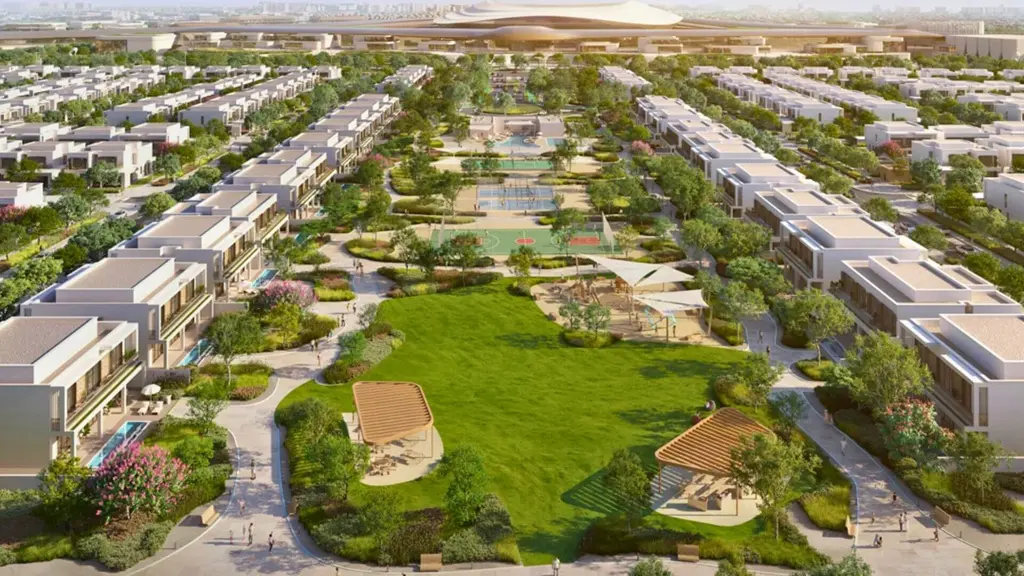
Wadeem Gardens is a villa community on Hudayriyat Island in Abu Dhabi. Its location becomes more meaningful when viewed as part of the island’s wider development plan.
The project sits among several planned residential districts, villa communities and waterfront areas. Roads connect these sections with each other and with the wider Abu Dhabi urban area.
This makes the location story bigger than the villas themselves. The surrounding districts will play an important role in how the area functions as development progresses.
Where is Wadeem Gardens located?
The development is situated on Hudayriyat Island, Abu Dhabi, within the western part of the island’s planned residential area.
This setting places the villas within a larger low-density residential cluster rather than a standalone enclave.
How the Hudayriyat masterplan is organised
The wider plan uses several named districts to divide the Hudayriyat island into identifiable areas.
The main residential groupings include:
- Wadeem
- Bashayer
- Nawayef
- Al Naseem
The island is also divided into Hudayriyat East, Hudayriyat West and Hudayriyat Central. These geographic labels provide a useful way to understand how individual communities fit into the larger development.
For property buyers, this distinction matters. The future surroundings will be shaped by several districts developing alongside one another.
Wadeem Gardens adds another villa district
Wadeem Gardens is a separate villa-focused area shown on the map.
Its presence provides useful context for the type of housing planned in this part of the island. Along with Wadeem Gardens, it forms part of a wider concentration of villa-led development.
This means the local housing mix is expected to include several low-density communities rather than a single large project.
Bashayer brings together different residential formats
The Bashayer section includes Bashayer Villas and Bashayer Residences.
Bashayer Villas adds another cluster of villa housing. Bashayer Residences represents a separate residential format within the same broader area.
The distinction is useful when reading the map. It shows that the wider plan is not based on one housing type. Different residential formats are being placed across the island.
Bashayer Marina is also marked separately. Its inclusion adds a waterfront reference point close to the residential districts.
Nawayef covers several distinct districts
Nawayef is another major residential grouping on the island.
The map identifies:
- Nawayef Village
- Nawayef Park Views
- Nawayef East
- Nawayef West
Nawayef Village is shown as a separate residential destination. Nawayef Park Views is another identified district, while the East and West labels divide the wider Nawayef area geographically.
This structure gives a clearer indication of the scale of planned housing across Hudayriyat.
It also means that future residents will share the wider island environment with several other established or planned neighbourhoods.
Al Naseem forms another residential pocket
Al Naseem Community is another named residential area on the map.
Its inclusion alongside Wadeem, Bashayer and Nawayef shows the number of separate residential destinations planned across the island.
For buyers, the relevance is practical. A larger residential base can support a broader local environment once different sections become occupied.
Hudayriyat East, West and Central
The wider development is divided into three geographic sections: East, West and Central.
These labels help place the individual neighbourhoods within the island’s overall structure. They are particularly useful when reading the masterplan because they show that the project forms part of a much larger geographic framework.
Rather than viewing each named area separately, buyers can use these divisions to understand the relationship between different parts of Hudayriyat.
Road connectivity across the island
Road infrastructure is one of the clearest features shown on the map.
Routes connect the various residential districts and provide movement across the wider island. They are not limited to individual developments. Instead, they form part of a shared transport network for the wider area.
This has a direct effect on daily living.
Residents need practical connections between their homes, other neighbourhoods and the rest of Abu Dhabi. As more sections become operational, these links will become increasingly important to the functioning of the island.
Connection with Abu Dhabi’s major islands
Hudayriyat Island sits within a wider network of Abu Dhabi destinations.
The map places Abu Dhabi city, Al Reem Island, Saadiyat Island, Yas Island and Lulu Island around the wider setting. It also identifies landmarks such as the Sheikh Zayed Grand Mosque and Abu Dhabi Financial Centre.
This gives the project an island location without separating it from the wider city.
For residents, that wider relationship is an important part of the location assessment.
Yas Island and Saadiyat provide wider context
Yas Island and Saadiyat Island are two notable reference points on the map.
Yas is associated with entertainment and leisure destinations. Saadiyat has a strong cultural, residential and waterfront presence. Their position relative to Hudayriyat shows how the island fits into Abu Dhabi’s broader coastal development pattern.
This context helps explain why the location cannot be assessed only by looking at the immediate streets around the villas.
What the surrounding communities mean for buyers
The most useful feature of the plan is its scale.
Several residential districts are positioned around the development. Wadeem Villas and Bashayer Villas add villa-focused housing. Bashayer Residences provides another residential format. Nawayef covers multiple districts, while Al Naseem Community adds another residential cluster.
The effect will depend on how these planned areas are delivered and occupied.
That is an important distinction for buyers of property in a developing masterplan. The map shows the intended structure, but the final character of the area will depend on future delivery and operation.
Wadeem Gardens location in simple terms
The location can be summarised as:
Wadeem Gardens → Hudayriyat Island → Abu Dhabi
Within the island, it sits among several planned residential districts.
Beyond the island, the wider map connects the area with Yas Island, Saadiyat Island, Al Reem Island and Abu Dhabi city.
This gives buyers three useful levels of context:
- The immediate villa community.
- The surrounding Hudayriyat neighbourhoods.
- The wider Abu Dhabi urban network.
What the masterplan tells you
The map provides a useful view of how the area is expected to develop.
It shows a sizeable residential structure with multiple villa and housing districts. It also shows how these areas are connected through roads and positioned within the wider Abu Dhabi island network.
For someone considering a property here, the important point is not simply the name or position of one project.
The surrounding plan matters too.
The mix of villa communities, residential districts, waterfront areas and road connections will influence how the locality functions over time. Wadeem Gardens is therefore best assessed as part of the wider Hudayriyat Island development, not as an isolated residential project.
Leave a Reply